
File:Route Twisk.png
預覽大小:202 × 599 像素。 其他解析度:81 × 240 像素 | 162 × 480 像素 | 259 × 768 像素 | 1,157 × 3,431 像素。
原始檔案 (1,157 × 3,431 像素,檔案大小:2.07 MB,MIME 類型:image/png)
摘要
| 描述 |
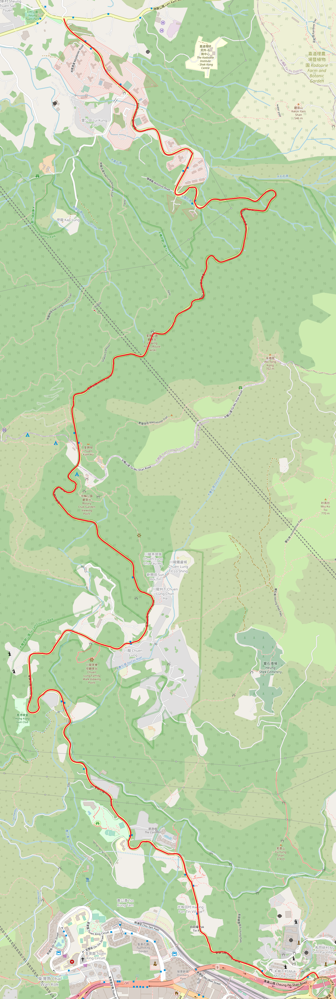
中文(香港):荃錦公路地圖,走綫以紅色表示 |
| 日期 | |
| 來源 | https://www.openstreetmap.org/#map=15/22.3940/114.1071&layers=N |
| 作者 | OpenStreetMap contributors |
授權條款
| This work contains information from OpenStreetMap, which is made available under the Open Database License (ODbL).
The ODbL does not require any particular license for maps produced from ODbL data. Prior to 1 August 2020, map tiles produced by the OpenStreetMap Foundation were licensed under the CC-BY-SA-2.0 license. Maps produced by other people may be subject to other licences. |
檔案歷史
點選日期/時間以檢視該時間的檔案版本。
| 日期/時間 | 縮圖 | 尺寸 | 用戶 | 備註 | |
|---|---|---|---|---|---|
| 目前 | 2020年9月6日 (日) 07:13 | 1,157 × 3,431(2.07 MB) | ThirdThink | Uploaded a work by OpenStreetMap contributors from https://www.openstreetmap.org/#map=15/22.3940/114.1071&layers=N with UploadWizard |
檔案用途
下列頁面有用到此檔案: