
File:How satellite radar altimetry works (16980176380).jpg
預覽大小:797 × 600 像素。 其他解析度:319 × 240 像素 | 638 × 480 像素 | 904 × 680 像素。
原始檔案 (904 × 680 像素,檔案大小:168 KB,MIME 類型:image/jpeg)
.jpg?uselang=zh-mo)
.jpg?uselang=zh-mo)
.jpg?action=history&uselang=zh-mo)
.jpg)
摘要
| 描述 |
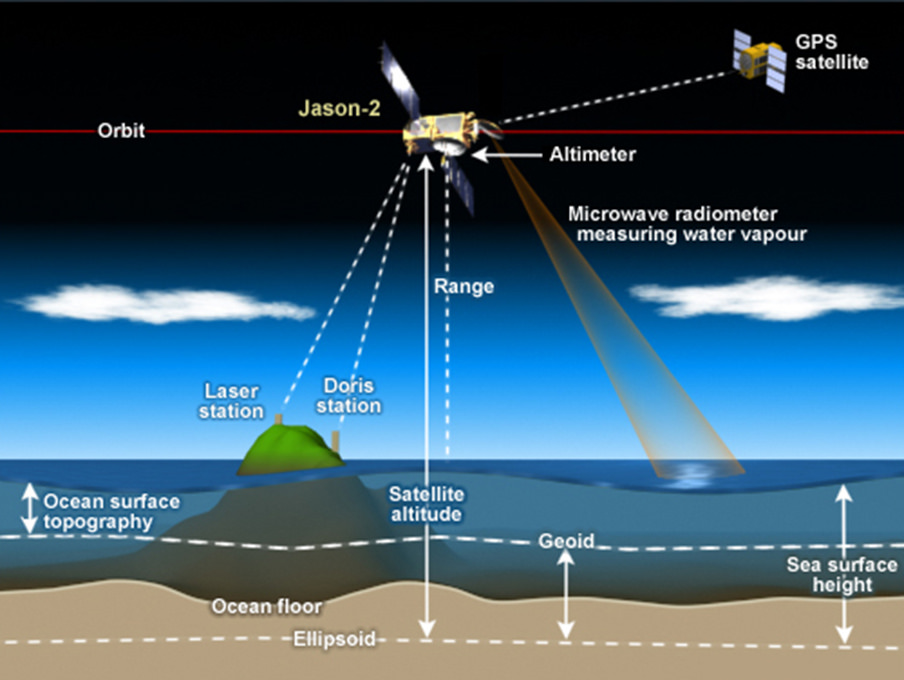
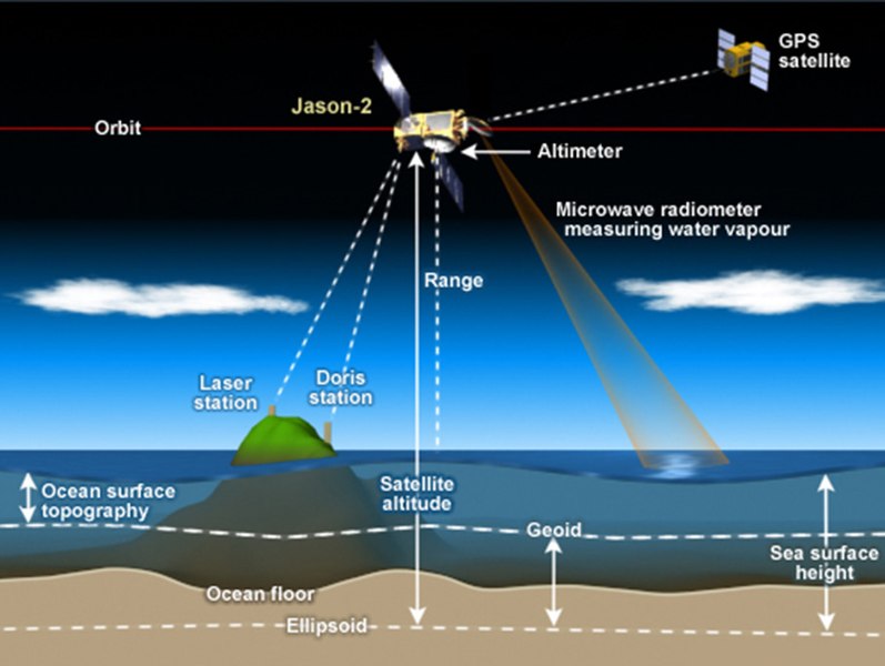
How satellite radar altimetry works Satellite radar altimeters measure the ocean surface height (sea level) by measuring the time it takes a radar pulse to make a round-trip from the satellite to the sea surface and back.
|
| 日期 | |
| 來源 | How satellite radar altimetry works |
| 作者 | NOAA Satellites |
授權條款
本圖像屬於公有領域,因該作品最初來自於美國國家海洋和大氣管理局職員的職務作品。
|
| This image, originally posted to Flickr, was reviewed on 2 August 2016 by the administrator or reviewer Amitie 10g, who confirmed that it was available on Flickr under the stated license on that date. |
檔案歷史
點選日期/時間以檢視該時間的檔案版本。
| 日期/時間 | 縮圖 | 尺寸 | 用戶 | 備註 | |
|---|---|---|---|---|---|
| 目前 | 2016年7月17日 (日) 12:24 | | 904 × 680(168 KB) | Pline | Transferred from Flickr via Flickr2Commons |
.jpg)