
File:Hernando de Soto Bridge Memphis.jpg

預覽大小:625 × 599 像素。 其他解析度:250 × 240 像素 | 501 × 480 像素 | 801 × 768 像素 | 1,068 × 1,024 像素 | 1,500 × 1,438 像素。
原始檔案 (1,500 × 1,438 像素,檔案大小:391 KB,MIME 類型:image/jpeg)
| 描述 |
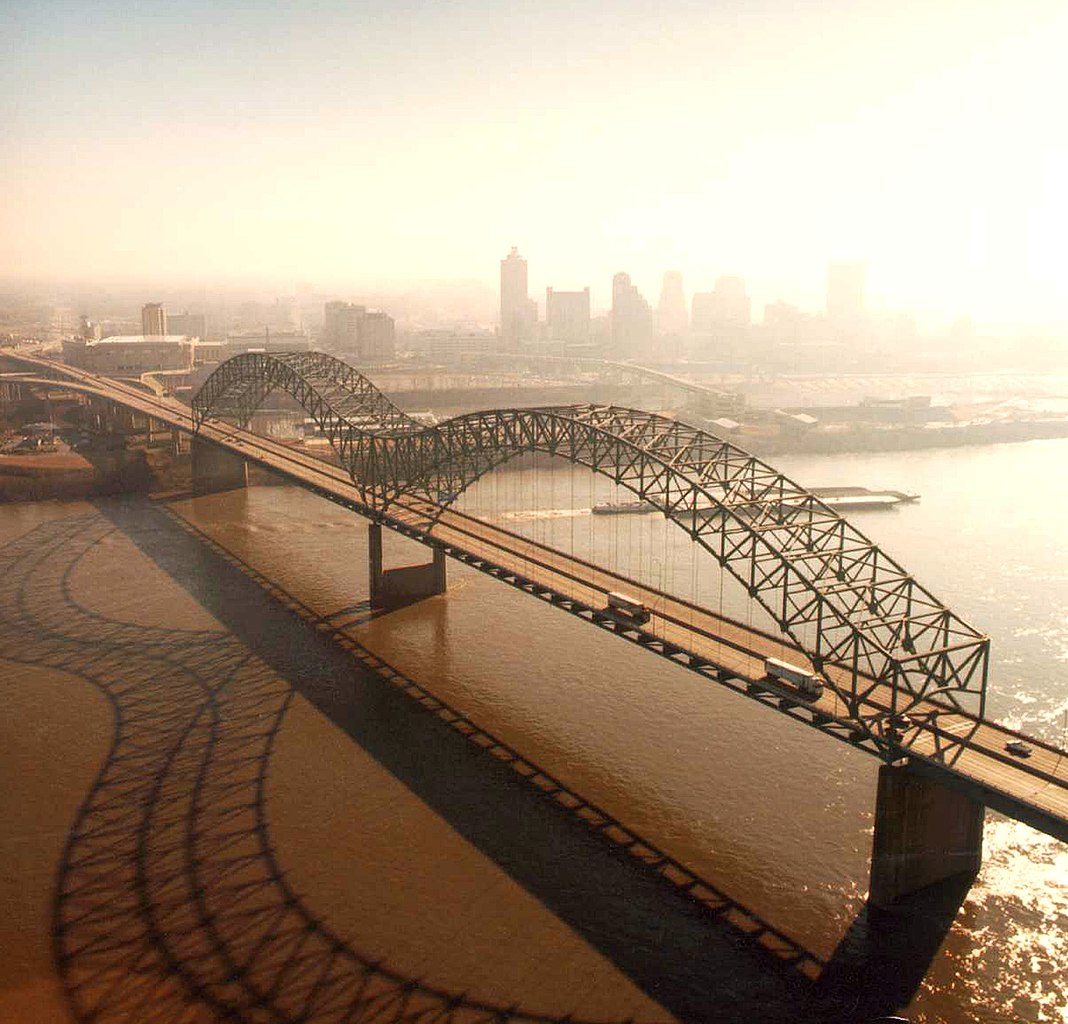
English: Aerial view of the Hernando de Soto Bridge across the Mississippi River between Memphis, Tennessee and West Memphis, Arkansas, USA. The bridge was opened in 1973 and carries six lanes of Interstate-40 across the river. View is from the Arkansas side to the east-southeast across the river to Memphis.
At thumbnail size, image appears clear, at the size on the image page small artifacts can be seen, but at 100% (actual size) the image is heavily artifacted with JPG compression blocks over the entire photograph. |
|||
| 日期 | ||||
| 來源 |
U.S. Army Corps of Engineers Digital Visual Library Image page Image description page Digital Visual Library home page |
|||
| 作者 | Larry Donald, U.S. Army Corps of Engineers | |||
| 授權許可 (重用此檔案) |
|
|||
| 圖中地點 | Memphis, Tennessee, USA |
| 拍攝地點 | | 位於此地的本圖片與其他圖片: OpenStreetMap |
|---|
檔案歷史
點選日期/時間以檢視該時間的檔案版本。
| 日期/時間 | 縮圖 | 尺寸 | 用戶 | 備註 | |
|---|---|---|---|---|---|
| 目前 | 2007年4月6日 (五) 01:34 | | 1,500 × 1,438(391 KB) | DanMS | {{Information | Description = {{en|Aerial view of the Hernando de Soto Bridge across the Mississippi River between Memphis, Tennessee and West Memphis, Arkansas, USA. The bridge was opened in 1973 and carries six lanes of Interstate-40 across the river |
檔案用途
全域檔案使用狀況
以下其他 wiki 使用了這個檔案:
- ar.wikipedia.org 的使用狀況
- arz.wikipedia.org 的使用狀況
- ast.wikipedia.org 的使用狀況
- bo.wikipedia.org 的使用狀況
- cs.wikipedia.org 的使用狀況
- de.wikipedia.org 的使用狀況
- en.wikipedia.org 的使用狀況
- Interstate 40
- Talk:List of longest arch bridge spans
- Wikipedia:What is a featured picture?/Examples of technical problems
- Image quality
- Interstate 40 in Tennessee
- Wikipedia:Featured picture candidates/January-2008
- Wikipedia:Featured picture candidates/Image:Hernando de Soto Bridge Memphis.jpg
- Culture of Memphis, Tennessee
- en.wikivoyage.org 的使用狀況
- eo.wikipedia.org 的使用狀況
- es.wikipedia.org 的使用狀況
- fa.wikipedia.org 的使用狀況
- fr.wikipedia.org 的使用狀況
- fr.wikibooks.org 的使用狀況
- fy.wikipedia.org 的使用狀況
- gl.wikipedia.org 的使用狀況
- gu.wikipedia.org 的使用狀況
- hi.wikipedia.org 的使用狀況
- hu.wikipedia.org 的使用狀況
- id.wikipedia.org 的使用狀況
- io.wikipedia.org 的使用狀況
- ja.wikipedia.org 的使用狀況
- la.wikipedia.org 的使用狀況
- mr.wikipedia.org 的使用狀況
- pl.wikipedia.org 的使用狀況
- ru.wikipedia.org 的使用狀況
- sh.wikipedia.org 的使用狀況
檢視此檔案的更多全域使用狀況。