
File:Hun Kal crater on Mercury.jpg
預覽大小:704 × 600 像素。 其他解析度:282 × 240 像素 | 564 × 480 像素 | 902 × 768 像素 | 1,202 × 1,024 像素 | 1,294 × 1,102 像素。
原始檔案 (1,294 × 1,102 像素,檔案大小:310 KB,MIME 類型:image/jpeg)
摘要
| 描述 |
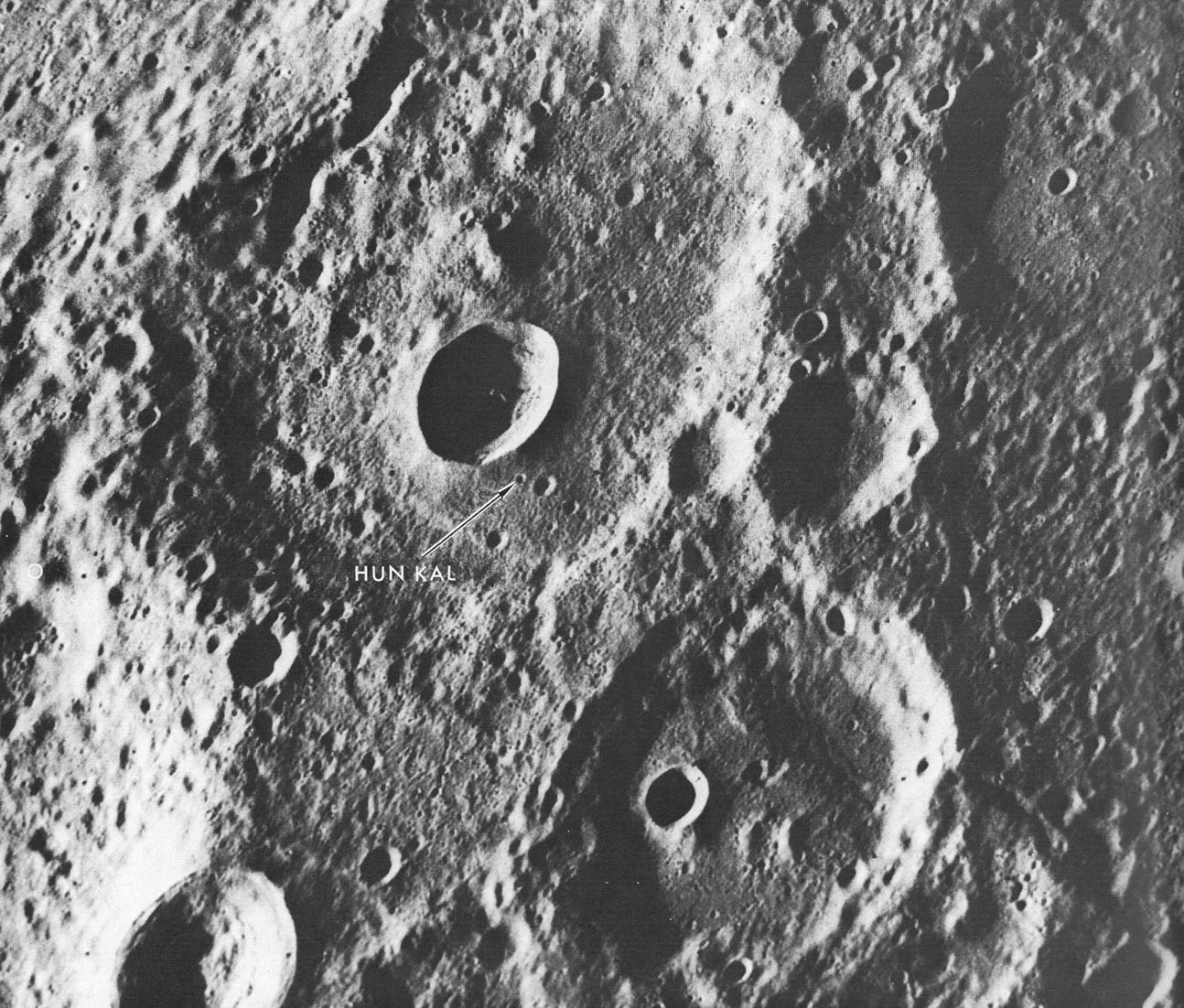
English: A fresh new crater in the center of an older crater basin provides a landmark for the tiny crater named Hun kal- the Mayan number 20 - which is the basis for positioning the longitudes on Mercury. By definition, the 20° meridian passes through the center of this small crater. Assuming that the spin axis of Mercury is perpendicular to its orbital plane, the latitude of Hun Kal is 0.23°S. This picture, which covers an area of 130 by 170 km ( 90 by 105 mi), was taken from a distance of about 20,700 km (12,860 mi), a half-hour before Mariner made its first close flyby of Mercury, March 1974. |
| 來源 | http://history.nasa.gov/SP-424/p112.htm |
| 作者 | Mariner 10 |
| 其他版本 | cropped to show Hun Kal more plainly |
授權條款
| 本作品由NASA創作,屬於公有領域。根據NASA的版權政策:“NASA的創作除非另有聲明否則不受版權保護。”(參見:Template:PD-USGov/zh,NASA版權政策或JPL圖像使用政策) | ||
 |
警告:
|
檔案歷史
點選日期/時間以檢視該時間的檔案版本。
| 日期/時間 | 縮圖 | 尺寸 | 用戶 | 備註 | |
|---|---|---|---|---|---|
| 目前 | 2008年4月9日 (三) 21:06 | | 1,294 × 1,102(310 KB) | Bryan Derksen | {{Information |Description={{en|A fresh new crater in the center of an older crater basin provides a landmark for the tiny crater named Hun kal- the Mayan number 20 - which is the basis for positioning the longitudes on Mercury. By definition, the 20° me |
檔案用途
下列頁面有用到此檔案:
全域檔案使用狀況
以下其他 wiki 使用了這個檔案:
- en.wikipedia.org 的使用狀況
- fr.wikipedia.org 的使用狀況
- hy.wikipedia.org 的使用狀況
- ja.wikipedia.org 的使用狀況
- ml.wikipedia.org 的使用狀況
- pl.wikibooks.org 的使用狀況
- ru.wikipedia.org 的使用狀況