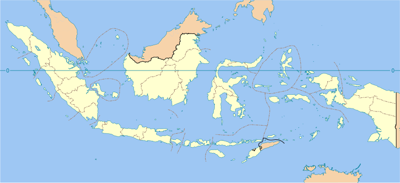
File:Indonesia provinces blank map.svg

此SVG文件的PNG预览的大小:786 × 361像素。 其他分辨率:320 × 147像素 | 640 × 294像素 | 1,024 × 470像素 | 1,280 × 588像素 | 2,560 × 1,176像素。
原始文件 (SVG文件,尺寸为786 × 361像素,文件大小:853 KB)
文件历史
点击某个日期/时间查看对应时刻的文件。
| 日期/时间 | 缩略图 | 大小 | 用户 | 备注 | |
|---|---|---|---|---|---|
| 当前 | 2022年12月11日 (日) 16:56 |  | 786 × 361(853 KB) | NordNordWest | upd Papua |
| 2022年7月2日 (六) 15:40 |  | 786 × 361(838 KB) | Bondguevara | Three recently formed Papuan provinces added | |
| 2020年10月22日 (四) 19:53 |  | 786 × 361(721 KB) | RXerself | Fix Menui as not Southeast Sulawesi; fix maritime borders traversing Marore Islands; fix lakes in East Kalimantan without ones in South Sulawesi; fix South-Southeast Sulawesi border; fix maritime borders traversing Liukang Tangaya; fix Banggai Laut-Taliabu border to hopefully cover Timpaus; fix Timor Leste as international border; I wouldn't add any maritime international/provincial borders if it were me since correct sources are scarce and a lot of islands got trampled over like this | |
| 2020年10月17日 (六) 01:56 |  | 786 × 361(714 KB) | Afrogindahood | Small addition of water borders | |
| 2020年10月15日 (四) 21:59 |  | 786 × 360(710 KB) | Afrogindahood | Fixes on some provincial water border errors, addition of coastline on Java | |
| 2020年7月16日 (四) 19:04 |  | 1,322 × 620(214 KB) | Delusion23 | Atauro is in Timor-Leste, not Indonesia | |
| 2013年8月22日 (四) 11:24 |  | 1,322 × 620(202 KB) | Gunkarta | Add border between East Kalimantan and North Kalimantan (new province formed on 25 October 2012, separated from East Kalimantan) | |
| 2007年2月21日 (三) 11:04 |  | 1,322 × 620(389 KB) | Bwmodular | Added border between Bali and West Nusa Tenggara. Removed arrow from strait between Bali and Lombok. | |
| 2007年2月7日 (三) 10:24 |  | 1,322 × 620(388 KB) | Bwmodular | Same as previous version, have just tidied up provincial boundaries so they don't poke out beyond coastal boundaries. | |
| 2007年2月5日 (一) 17:28 |  | 1,322 × 620(388 KB) | Bwmodular | Identical to previous version, just tidying up some of the boundary lines so they don't spill into the ocean. |
文件用途
以下6个页面使用本文件:
全域文件用途
以下其他wiki使用此文件:
- ace.wikipedia.org上的用途
- af.wikipedia.org上的用途
- ar.wikipedia.org上的用途
- ban.wikipedia.org上的用途
- Propinsi ring Indonésia
- Mal:Indonésia/TOC
- Mal:Location map Indonésia (propinsi)
- Kecamatan miwah kelurahan ring Indonésia
- Kabupatén miwah kota ring Indonésia
- Gending daérah Indonésia
- Lis Tetamian Budaya Tenbenda Indonésia
- Perguruan tinggi negeri ring Indonésia
- Lis kode télépon ring Indonésia
- Rumah sakit ring Indonésia
- Lis tukad ring Indonésia
- Genah wisata ring Indonésia
- Lis nusa Indonésia
- Kabupatén miwah kota ring Indonésia manut galah pawentukannyané
- Lis wawidangan pemilihan propinsi Indonésia
- Mal:Peta Indonésia
- Museum ring Indonésia
- bbc.wikipedia.org上的用途
- bcl.wikipedia.org上的用途
- be.wikipedia.org上的用途
- bn.wikipedia.org上的用途
- bs.wikipedia.org上的用途
- ceb.wikipedia.org上的用途
- ckb.wikipedia.org上的用途
- crh.wikipedia.org上的用途
- da.wikipedia.org上的用途
- en.wikipedia.org上的用途
- Indonesia
- Provinces of Indonesia
- User:Bwmodular/Sandbox
- User:Imoeng/sandbox
- Template:Indonesia provinces labelled map
- Module:Location map/data/Indonesia provinces/doc
- User:Jonny-mt/Gallery of current first-level administrative country subdivisions maps
- Outline of Indonesia
- List of rivers of Indonesia
- List of Indonesian provinces by GRP per capita
- Wikipedia:Graphics Lab/Map workshop/Archive/Aug 2018
- Module:Location map/data/Indonesia provinces
- List of Indonesian provinces by GDP
- en.wikiversity.org上的用途
查看此文件的更多全域用途。


