
File:Indianapolis.svg

此SVG文件的PNG预览的大小:629 × 600像素。 其他分辨率:252 × 240像素 | 504 × 480像素 | 806 × 768像素 | 1,074 × 1,024像素 | 2,149 × 2,048像素 | 1,624 × 1,548像素。
原始文件 (SVG文件,尺寸为1,624 × 1,548像素,文件大小:723 KB)
| 本作品已被作者SPUI释出到公有领域。这适用于全世界。 在一些国家这可能不合法;如果是这样的话,那么: |
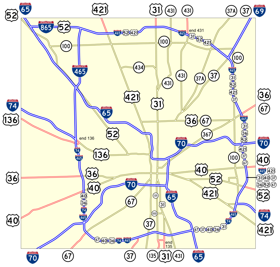
Map of numbered routes in Indianapolis, Indiana. Traced on USGS topos. Information is from the maps and photos on [1].
- Blue: Interstate
- Red: Current route
- Yellow: Former route
If you need a thumbnail use Image:Indianapolis.png.
An alternate version at Image:Indianapolis numbered routes labeled.svg shows street names.
文件历史
点击某个日期/时间查看对应时刻的文件。
| 日期/时间 | 缩略图 | 大小 | 用户 | 备注 | |
|---|---|---|---|---|---|
| 当前 | 2006年6月4日 (日) 17:27 | | 1,624 × 1,548(723 KB) | SPUI~commonswiki | {{spuimap}} Map of numbered routes in Indianapolis, Indiana. Traced on USGS topos. Information is from the maps and photos on [http://illi-indi.com/IndianaHighwayList.php]. *Blue: Interstate *Red: Current route *Yellow: Former route If you need a thumbnai |
文件用途
以下页面使用本文件:
全域文件用途
以下其他wiki使用此文件:
- en.wikipedia.org上的用途
- fi.wikipedia.org上的用途
- fr.wikipedia.org上的用途
- ja.wikipedia.org上的用途
- nl.wikipedia.org上的用途
- simple.wikipedia.org上的用途
- www.wikidata.org上的用途